Categories
General Rapidways Stations Uncategorized Urban Planning vivaNext.com

Glossary of construction terms

Construction can be chaotic for the layperson with its oddly shaped machines digging, drilling and moving around dirt, concrete and other large items. It can be hard to understand what they’re doing exactly, but things can get even more confusing when construction terminology gets thrown around. To help anyone who might be interested we’ve compiled a list of our most often used terms, just for the fun of it –

Abutment A structure located at the ends of a bridge, where the bridge slab adjoins the approaching roadway.
   
Archaeological Testing/Assessment The examination of limited areas for the purposes of identifying historical artifacts. We do this work to meet the requirements of the 2007 North Yonge Street Corridor Public Transit Improvements Environmental Assessment, which identifies areas of potential archaeological interest along the Yonge Street corridor, so that we can ensure any important historical artifacts are identified before the roadway is widened for the rapidway.
   
Backfill Material used to replace, or the act of replacing material, removed during construction. Also, may denote material placed, or the act of placing material, adjacent to structures.
   
Bore Holes Drilling into the ground to bring up samples of earth for testing.
   
Boulevard A strip of grass between a sidewalk and a road, located above a curb.
   
Bridge Pier A supporting structure at the junction of connecting spans of a bridge.
   
Caissons A cylindrical concrete foundation that penetrates through soil to rest upon an underlying stratum of rock. Or the structural support for a type of foundation wall.
   
Canopy A curved glass and steel structure over a vivastation platform that shelters passengers.
   
Cast-in-Place A construction of forms filled with concrete at the final location.
   
Catch Basin A receptacle for catching water runoff from a designated area; usually a shallow concrete box with a grating and a discharge pipe leading to a plumbing or stormwater system.
   
Cofferdam A watertight steel enclosure from which water is pumped to expose the bottom of a body of water and permit foundation construction.
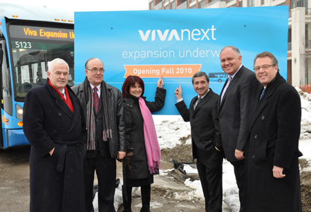
   
Corridor Area where vivaNext has construction underway – e.g. Highway 7 East, Highway 7 West, Davis Drive or Yonge Street.
   
Culvert A drain pipe or small bridge for drainage under a road or structure.
   
Cut and Cover A method of tunnel construction that involves digging a trench, building a tunnel, and then covering it with fill.
   
Daylighting The process of exposing buried utility lines to daylight.
   
Directional Drilling Drilling sideways under structures, roadways, streams, etc. to place pipes, utility lines without excavation and generally limited to less than 30cm in diameter.
   
Duct bank Groups of conduits designed to protect and consolidate cabling to and from buildings. Data and electrical cables are laid out within PVC conduits and bundled together; these groupings of conduit are protected by concrete and metal casings. Duct banks are often buried, allowing contractors to consolidate the wiring for a building into centralized underground paths.
   
Easement An interest in land owned by another that entitles its holder to a specific limited use.
   
Environmental Impact The effects a project will have upon the environment, especially the human environment.
   
Environmental Testing Is used to verify if a piece of equipment can withstand the rigors of harsh environments.
   
Excavator Generally tracked vehicle with rotating body and front mounted digging arm.
   
Geotechnical Testing The process of boring, sampling, and testing the soil at various depths to enable the geotechnical engineer to discover and analyze characteristics of the soil.
   
Guy Wires A wire used to secure a tall exterior mast, antenna, or other structure in place.
   
Hoarding A temporary wooden fence around a building or structure under construction or repair.
   
Hydrovac A large truck-mounted vacuum used to bore holes to locate underground utility cables and pipes.
   
Locates Markings that locate underground infrastructure, identified as follows:

  • Red – Electric power lines, cables and conduit systems and lighting cables
  • Yellow – Gas, oil, steam, petroleum, gaseous or dangerous materials
  • Orange – Communications, cable television, alarm or signal lines, cables or conduit systems
  • Blue – Water, irrigation and slurry lines
  • Green – Sewer and drain lines
  • White – Route of proposed subsurface line or location of proposed excavation
  • Purple – Reclaimed water
  • Pink (fluorescent) – Temporary construction project site survey markings and survey monuments.


Man Hole A hole through which a person may go to gain access to an underground or enclosed structure.
   
Precast (PC) Piles A reinforced concrete pile which is moulded in circular, square, rectangular or octagonal form.
   
Pile Driver A noisy machine that repeatedly drops a heavy weight on top of a post-like foundation until it reaches solid soil, rock or cannot be pushed down any farther.
   
Potholing A small, steep-sided hole usually with underground drainage.
   
Rapidway Dedicated lanes for viva rapid transit down the centre of the road [except on Enterprise Drive, where the lanes are beside the road].
   
Re-bar Ribbed steel bars of various sizes used to give concrete strength in tension.
   
Sheet Piling Planking or sheeting made of concrete, timber, or steel that is driven in, interlocked or tongue and grooved together to provide a tight wall to resist the lateral pressure of water, adjacent earth or other materials.
   
Storm Sewer A sewer used for conveying groundwater, rainwater, surface water, or similar non-polluting wastes.
   
Test Pitting An excavation made to examine an existing foundation, or to determine whether an area is suitable for building construction; includes the taking of soil samples and the determining of the depth of groundwater.
   
Transformer A device that changes, or transforms, alternating current from one voltage to another.
   
Vaughan Metropolitan Centre (VMC) Area around Highway 7 West in the City of Vaughan designated as a new development area.
   
Vivastation A bus rapid transit station on a vivaNext rapidway. Includes a platform in each direction, like a train station.
   
Water Main Water supply pipe generally located at the street level which may supply a number of buildings.


Categories
Construction General Rapidways Stations Uncategorized Urban Planning vivaNext.com

Understanding real-time travel time signs

We’ve all seen them at one time or another, the big orange and black electronic message boards relaying construction information and how long it will take to travel through a construction zone. You may have asked yourself how these signs provide up-to-date travel time and are they accurate? Perhaps you even timed it to test its accuracy.

These signs are Variable Messaging Signs [VMS]. You may have also heard them referred to as construction message boards. You will see them posted at key locations along the vivaNext rapidway corridors currently under construction. The signs operate from a bank of batteries. Energy from the sun, collected by solar panels on the top of the sign, recharges the batteries allowing the construction information and real-time travel information to stay lit.

The real-time travel information works from innovative Bluetooth technology based sensors to calculate travel times through the construction zone. Once a minute, the current average travel time is posted to the VMS. We were the first in North America to track Bluetooth data and convert it into real-time travel time displays to help commuters decide the best way to minimize their travel time through construction.

So how accurate is the real-time travel data on these signs? We keep a close eye on the travel times displayed on the VMS. We continuously monitor and check the accuracy of these signs to ensure the travel times provided are precisely the time it takes to travel through the construction.

The VMS are just one example of the tools and technology we use to keep you informed of rapidway construction. Check out vivanext.com for the latest news and if you haven’t already, sign up for construction updates.

We thank you for your patience during vivaNext rapidway construction. Once the transformation is complete, the rapidways will help connect communities, save people travel time on viva and transform the physical look and feel of the streets to be beautiful refreshed places to visit, shop or work.


Categories
Subways

Spadina Subway: it’s about connections

Map of the extension to the Spadina Subway extension. Inset: future design of Vaughan Metropolitan Centre

Is it possible to live or work in northwest Toronto, western York Region or east side of Peel, and not know about the Toronto-York Spadina Subway Extension? Although you might know that a subway extension is planned, you might not know the details about this huge subway development project.

The extension to the University-Spadina TTC subway line from the current Downsview Station north to Highway 7 in Vaughan will be big news to anyone living or working along its route. A connection from Downsview Station to the Wilson Yard TTC storage and maintenance facility has already been built, and four Tunnel Boring Machines (TBMs) have been manufactured in Canada for this project. Each TBM took several months to build, and three weeks – 21 truckloads of parts – to deliver to its launch location. This spring the parts of the four TBMs will be lowered into their launch shafts at Sheppard West Station and Steeles West Station, and assembled in launch position. In the first of several tunnel drives, the TBMs at Sheppard West will bore northward to Finch West Station, and the TBMs at Steeles West will bore southward to York University Station. Each machine will bore at a rate of about 15 metres per day, and they’re multi-talented machines, excavating in front and placing tunnel reinforcements behind them. When they reach their destinations they’ll be removed from the ground and relocated to new launch locations for the next tunnel drive. The tunnelling is expected to take about two years, with the entire project, including stations, scheduled to be complete and in service by late 2015.

Highway 407 Station and the Vaughan Metropolitan Centre will be the first subway stations in York Region. Vaughan Metropolitan Centre will be built at Millway Avenue along the Highway 7 West rapidways, and will feature retail space, a domed roof with skylights positioned to reflect light to platform level, and pedestrian and transit-oriented development.

We talk about rapidways all the time, but really we’re developing a rapid transit network – a system to move people within our region and connect us to neighbouring transit networks. Subway extensions create a vital connection in the GTHA transit network, and will bring new life to communities near subway stations, as people gather in these areas to live, work, shop and play.

If you’re interested in more details about subway extensions, be sure to visit some of these links:

Categories
Urban Planning

Coming to your region soon: getting around the GTHA without a car

Viva Rider

Some of us can still remember when a drive across the Greater Toronto and Hamilton Area (GTHA) took you through a mixture of urban and rural scenery. Hard to believe now, isn’t it? Much of our region is now one interconnected, pretty much seamless urban expanse, from Hamilton all the way to Oshawa and beyond. And people’s travel patterns reflect this regional reality; many residents travel all over the GTHA for work, entertainment, shopping and recreation. We are truly citizens of a great region, not just of one town or city.

Unfortunately, getting around the GTHA by transit is anything but seamless. With nine separate transit services operated by various local and regional municipalities, connecting from service to service might require multiple transfers and waits at each municipal boundary. For some commuters, the hassle of transferring might make it easier to drive, even with all the congestion on our roads. Given all the environmental reasons for reducing car trips, that’s really a shame – but until there’s a better option, we know lots of people will stick to their cars.

The good news is that a more coordinated rapid transit network is on its way, and our vivaNext plan is going to play a large part.

Looking at the map created by Metrolinx you can see how the future system will be a truly regional transit network. With multiple connection points linking various new services, this new network is going to make it easier and faster for commuters to take rapid transit – whether that means a subway, bus rapid transit, or light rail transit – from one end of the GTHA to the other.

And Metrolinx is currently evaluating a whole range of other rapid transit options, including extending the Yonge Subway up to the Richmond Hill Centre. So as these other projects are funded, the regional network will become even bigger and better.

At the same time as the physical connections are being increased, Metrolinx has also been implementing their new Presto card, which allows you to use one fare card on most GTHA transit systems.

We’re really excited about being part of this huge plan to extend continuous rapid transit all across the GTHA. We know that once this network is built, leaving your car at home and taking rapid transit will finally be a convenient, comfortable and fast option, no matter where you want to go.

Categories
Announcements Rapidways

We’re on our way!!

metrolinx-announcement_2010_05_20

Yesterday, we got positive news.  But first: rewind back to March 2010, when the Province announced in their budget that, due to their major financial pressures, they would need to rejig their transit spending schedule, to focus on getting the most urgent projects built first.  So we sat down with Metrolinx to work through our plans.  We needed to figure out the best schedule that would still benefit the region-wide transit system, but with some pieces coming sooner and others coming later.  It took a lot of hard work, and yesterday, Metrolinx announced the proposed new schedule.

Metrolinx’ board gave its unanimous endorsement to the proposed plan, which means the vivaNext projects can continue to move forward, one in each of Markham, Newmarket, Richmond Hill and Vaughan. This first phase of building will see York Region getting $790 million for rapid transit expansion over the next five years.

The plan also has a second series of rapidways, which will expand the rapid transit foundation established through the first set of routes. This second phase will get $965 million for projects to be constructed between 2016 and 2020.

The bottom line is that between these two phases, the entire vivaNext plan as originally announced in April 2009 will be built. We’ve always believed that the vivaNext plan is one of the keys to getting the GTA moving, and now, after working closely with our partners at Metrolinx, we believe that the revised plan will still help us address the building gridlock that’s such a risk for us all. That’s good news for York Region, and for everyone who lives or works here.

So with this revised schedule now approved, we can really get underway towards building the vivaNext vision of true rapid transit for York Region. We’ve got our design teams, our engineers and our construction crews all revved up to finalize their planning and, as the Metrolinx proposal is confirmed by the province next month, we can keep on going. So keep visiting us at vivaNext.com for updates and news as we, with real excitement, get on our way!

Categories
Announcements General Urban Planning vivaNext.com

Reflecting back on a year of many milestones!

With a new year just around the corner, we wanted to celebrate by reflecting back on some significant milestones for vivaNext in 2009.

In early spring, the Province of Ontario committed $1.4 billion for the construction of dedicated rapidways along Davis Drive, Highway 7 and Yonge Street for Viva vehicles.

The following month, the Ministry of the Environment unconditionally approved the Environmental Project Report for the proposed Yonge subway extension.

Around this time, our new website was also launched along with this blog and other social media initiatives to help keep you informed of all the latest vivaNext developments.

By the fall, preliminary rapidway construction activities were underway in Newmarket and Markham, and a contract for conceptual design work regarding the Yonge subway extension was awarded. In addition, preliminary station designs were also unveiled for several of the Spadina subway extension stations at a series of public open houses, and the project took an important step forward with a groundbreaking ceremony at the Wilson Subway Yard.

Then, just before the holiday season, a ceremony was held on the site of the planned rapidway alongside Enterprise Drive in Markham (which is part of the Highway 7 rapidway project) to commemorate the start of construction of the first 37 km of rapidways.

From every side of York Region, this past year has been filled with milestones for the vivaNext projects. We look forward to bringing you many more in 2010.

Happy New Year from vivaNext!

Reminder: All YRT\Viva rides are free on New Year’s Eve after 7 p.m.

Categories
Announcements Press Rapidways

Rapidway construction begins in York Region on Enterprise Drive!

Today, an on-site ceremony was held on Enterprise Drive in Markham to commemorate the start of 70 kilometres of vivaNext rapidway construction in York Region.

VivaNext – York Region’s plan for the next generation of rapid transit – includes a network of several rapidways across the Region. They are the east-west Highway 7 rapidway from Highway 50 in Vaughan to Reesor Road in Markham, the north-south Yonge Street rapidway from the Richmond Hill Centre Terminal in Richmond Hill to Green Lane in Newmarket, and the east-west Davis Drive rapidway from Yonge Street to the Southlake Regional Health Centre in Newmarket.

The rapidways will take Viva vehicles out of mixed traffic and into their own dedicated lanes, where they will safely speed past congestion, no matter what time of day.

The 800 metres of rapidways being built on Enterprise Drive, between Warden Avenue and Birchmount Road, are part of the Highway 7 rapidway project.

“This construction phase is truly significant, as it marks the beginning of a new stage of rapid transit in York Region,” said York Region Chairman and CEO Bill Fisch. “Together with the Government of Ontario, we are building a modern transit system to ensure we keep pace with the planned growth in York Region and preserve the quality of life our residents have come to expect.”

Rapidway construction on Enterprise Drive, which will be completed by the end of 2010, will involve the installation of concrete platform foundations, curbs, and the placement of station canopies. No road closures will be required; only short-term temporary lane closures.

“This is great news for the people of York Region and the GTA,” said Markham-Unionville MPP Michael Chan. “The project signals the start of a faster, more convenient rapid transit network that will enable people to get around more easily, improve the ability of our businesses to grow and succeed and help improve the environment.”

As construction of the rapidways gets underway, we encourage you to add vivanext.com to your list of favourite websites for quick and easy access to the latest information and construction updates. While there, you can also sign up to receive our quarterly e-newsletter in your Inbox, along with customized email updates about vivaNext projects of particular interest to you.

Categories
Announcements Press Subways

Big step toward starting construction on the Spadina subway extension

Chair Fisch and the other dignitaries pose for cameras in front of a scale model of a tunnel boring machine.

Lovat, an Ontario-based company that makes tunnel boring equipment, has been awarded a $58-million contract to build four machines that will be used in the construction of the Spadina subway extension.

The announcement was made last Friday, August 7, at the Lovat plant by Ontario Transportation Minister Jim Bradley, joined by MP Bob Dechert, York Regional Chair and CEO Bill Fisch, TTC Chair Adam Giambrone and Lovat President Dick Cooper. Not only does this mean the creation of some 200 jobs in the GTA and a boost to the economy, it signals continued progress on the project as it’s scheduled to open in 2015.

Prior to the announcement, I had the pleasure of joining the group for a bit of a tour of Lovat. We met at one end of their Mississauga plant and walked through to the other end while learning about what’s involved in making tunnel boring equipment. Cameras and reporters were waiting at the end of the tour to hear each dignitary deliver a short speech about the announcement.

It was awe-inspiring to watch the dignitaries being interviewed in front of a massive tunnel boring machine. They’re HUGE. Just take a look at the picture below to see how big they are compared to the people near them.

Lovat has built similar and even larger machines for projects all around the world, from Algeria to Venezuela. “We are pleased to be a part of this significant mass-transit project, as it not only generates jobs and strengthens infrastructure locally, but also highlights Canada’s technological capabilities on a global scale,” said Cooper.

The first two machines are expected to be delivered in the fall of 2010, with tunnel boring to begin shortly after.

York Regional Chairman Bill Fisch speaks to the audience and TV cameras in front of an actual tunnel boring machine last Friday.
York Regional Chair and CEO Bill Fisch speaks to the audience and TV cameras in front of an actual tunnel boring machine last Friday.
Categories
Studies Subways

Metrolinx’s interim report recommends subway over BRT on Yonge

What a transit sign may look like at the Richmond Hill Centre with connections to a subway, YRT and Viva busses, and GO trains.

Last Friday, Metrolinx released its interim Benefits Case Analysis (BCA) for the Yonge North Subway extension.

The BCA was developed by Metrolinx in collaboration with the City of Toronto, the Regional Municipality of York and the Toronto Transit Commission. The analysis looked at two subway options, and a bus rapid transit option.

Here are the key findings:

  • The subway options have a far greater positive impact on the environment, economy, land development and community than the BRT.
  • The economic impacts of the subway options are considerable – creating 21,800 person-years of employment.
  • Both subway options provide better service and reliability than the BRT. The BRT is not as reliable as the subway and would likely experience substantial overcrowding in peak hours.
  • The BRT is not considered a long term solution.
  • The BRT is likely limited by technology, and would not have sufficient capacity for the long-term needs of the corridor.

The proposed subway extension will meet up with the rapidways along Hwy. 7, which will soon get under construction. The combination of the rapidways and a connecting subway on Yonge St. creates a viable alternative to driving and will make it much easier for people to travel between York Region and Toronto.

While we would like to see the Yonge Subway extension proceed immediately, we know that projects of this magnitude can’t happen overnight. We will continue to work with all stakeholders and analyze the overall network elements, such as GO electrification impacts, the TTC capacity study at Yonge/Bloor, as well as the Downtown Relief Line.

The benefits of this project are significant and long-term. We will continue to work with all levels of government to ensure the funding is in place to keep this project moving forward.

The executive summary of the interim BCA is available here.

Categories
Press Rapidways Urban Planning

Metrolinx committed to breaking ground on vivaNext rapidways this fall.

Metrolinx President and CEO Rob Prichard takes questions from reporters after the public session of the July 13 meeting
Metrolinx President and CEO Robert Prichard takes questions from reporters after the public session of the July 13 meeting.

Metrolinx, the body created by the Government of Ontario to develop and implement an integrated transportation plan for the Greater Toronto and Hamilton Area, is committed to working with Viva toward a fall 2009 construction start date for the rapidways project. During their July 13th public board meeting, Metrolinx President and CEO Robert Prichard said, “Progress is going very well indeed. We want to break ground this fall and we are working hard to do so.” During the meeting, Metrolinx General Manager of Investment Strategy and Projects John Howe presented our renderings of the Davis Drive rapidway to show how it will look in the future. They generated a lot of excitement amongst those in attendance.

If you would like to see the renderings presented at the meeting for yourself click here or visit vivaNext.com, where you’ll also find a link to the Metrolinx website in case you are also interested in viewing the meeting agenda.