Categories
Announcements Rapidways Video

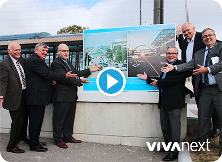
celebrating the completion of the Davis Drive rapidway

YouTube video: timelapse of Davis Drive

Last week, the Honourable Steven Del Duca, Minister of Transportation; Wayne Emmerson, Chairman and CEO, The Regional Municipality of York; Bruce McCuaig, President and CEO, Metrolinx; the Chairman of the YRRTC Board, Frank Scarpitti, Mayor of the City of Markham and Tony Van Bynen, Mayor of the Town of Newmarket, joined together to celebrate the transformation of Newmarket, with the completion of the bus rapid transit (BRT) rapidway project on Davis Drive.

The Davis Drive rapidway was opened for the new Viva service in November 2015, extending 2.7 kilometres from Yonge Street to Roxborough Road, with service continuing in mixed traffic another 2.3 kilometres with curbside stops and a turn-around at the new park and ride facility at Highway 404. This past spring, crews began work on the finishing touches such as planting trees and installing the last sections of sidewalk.

Rapid transit along Davis Drive promotes growth and development, and supports the priorities of the Town of Newmarket’s Strategic Plan, York Region’s Centres and Corridors plan, Metrolinx’s Regional Transportation Plan for the Greater Toronto and Hamilton Area (GTHA) and Ontario’s Growth Plan for the Greater Golden Horseshoe.

Along with providing a convenient new travel option, the Davis Drive rapidway project helped transform Newmarket with updated utilities, new infrastructure such as a water main and the Keith Bridge, and wider boulevards. These improvements will help support the continued growth and development in Newmarket’s town centre.

The Davis Drive rapidway has been years in the making. We’ve captured the entire transformation on video. Through all the planning, design and construction there’s something special about knowing that you’ve contributed to the future growth and prosperity of entire neighbourhoods, towns and regions by connecting people to the places they work, shop and play.

We would like to sincerely thank the community, businesses and residents that have supported the project from the outset, and endured the disruptions that come with long term construction. Your patience, understanding and feedback have been invaluable. Newmarket now has a rapid transit system we can all be proud of and enjoy for many years to come.

 

Categories
Technical

detecting vehicles at traffic lights >> a mystery solved

detecting vehicles at traffic lights >> a mystery solved

If you receive construction emails from us, you might know that we’ve installed vehicle detector loops at intersections with traffic signals. But if you’re like most people, traffic lights, and their various components [what are vehicle detector loops, anyway?] are probably one of those subjects you don’t give a lot of thought to. So next time you’re waiting for that light to change, here’s a primer on vehicle detector loops, and why you’ll be glad we’re installing them as part of our projects.

To begin with, vehicle detector loops [the technical term is “inductive-loop vehicle detectors”] are flat, loose coils of wire covered in light plastic, which are buried in the asphalt under the lanes at an intersection.

In York Region, most of our vehicle detector loops are approximately 4 metres square, and extend from the pedestrian crosswalk and across the stop bar [the wide white line going across each traffic lane at intersections] for approximately 15 metres.

The point of a vehicle detector loop is to detect when vehicles are sitting at the intersection. Vehicle detector loops are able to do this through a process of magnetic induction, which results when metal objects [i.e., vehicles] are nearby. Put simply, the presence of the vehicle results in a change in the magnetic field of the loop. This change is detected by the traffic signal controller [a large box located near every signaled intersection], which in turn sends a message to the traffic signal to begin turning from red to green.

York Region owns and or maintains 848 signalized intersections [traffic lights occasionally are used in other settings such as single lanes through construction zones]. Most of York Region’s traffic loops are located on side street lanes, in left turn lanes to activate advanced left turn signals, and on rapidways to detect transit vehicles.

The Region also uses “Matrix” vehicle detection, a pole-mounted system using radar imaging, in construction zones where lanes are moved, and where it’s problematic to install traffic loops. For more information on the technology of traffic signals, check out york.ca/intersections.

Ultimately, traffic loops improve the performance of an intersection, helping traffic flow by detecting you better.


Categories
Utilities

connecting the drops

connecting the drops

The importance of upgrading Canada’s infrastructure is everywhere in the news these days. Infrastructure includes everything from bridges to roads and transit, to utilities such as hydro lines, sewers and water mains. Each vivaNext project includes improvements to infrastructure and utilities, leaving a lasting legacy for residents and businesses. One of the most important pieces of infrastructure is a water main – bringing fresh water to your mealtime prep, your kids’ bath tub and even your local swimming pool. In Richmond Hill, the residents and businesses connecting to Yonge Street are getting a new, modern water main to prepare for future growth.

Although to some people it might not seem very glamorous, an important example of a major infrastructure improvement is the replacement of the Richmond Hill water main, which we’re doing as part of the vivaNext Yonge Street rapidway project. This work will replace 3.7 kilometres of water main along Yonge Street from just south of Garden Avenue [north of Highway 407] to Major Mackenzie Drive. The water main, which supplies water to the adjacent residents, is owned and maintained by the Town of Richmond Hill, with construction done by the vivaNext Design Build contractor.

Water main replacements, especially in busy thoroughfares like Yonge Street, require complex planning for design, staging and construction. As with all our work, we need to find a balance between a number of competing priorities. One priority is to maintain service to households and businesses who depend on the water main. Another priority is to get the work done in a way that minimizes disruption to traffic. And, as always, we need to plan the design and construction in a way that gets the most value for money, including future maintenance costs.

To avoid existing underground utilities and simplify construction, we’ll relocate the water main to run under the traffic lanes on Yonge Street. We also want to avoid locating it under the new planters that will be built along the sidewalk, in the event that future maintenance on the water main is needed.

Replacement water mains are generally located as close as possible to the original water main, to preserve existing connections to residences and businesses. As a result, construction proceeds more slowly to avoid any damage during excavation to the existing water main, which stays in use until the new one is ready for service.

To minimize disruption to traffic, workers will be building the new water main from inside a trench box, which significantly reduces the amount of space needed to carry out the construction compared to regular excavation. The benefit of constructing in less space is that fewer lane closures are needed during construction, which is critical on Yonge Street.

However, trench box construction has to move more slowly. The rigid trench box also makes it more challenging to work around conflicts with other buried infrastructure. From time to time we can expect progress to slow down while crews get around other underground utilities. Construction will be followed by a lengthy process of pressurizing, cleaning and testing, all to meet very strict government standards.

Once the new water main is ready to go, a new connection to each address along the main route will need to be made, along with additional connections to other water mains at intersections. Individual addresses are relatively straightforward to reconnect, but businesses and multi-unit residential buildings take longer, with connections to larger pipes and fire lines. This process of disconnection and reconnection will be planned ahead, with communication with each residence and business to minimize disruption.

We’re excited that the community is going to be getting a new water main, built to the most modern standards. Our team is working with the community during construction to help minimize any impacts to parking and driveways. And we’ll make sure there’s lots of clear signage to help guide you through construction areas.

It’s a huge project, and it’s going to be pretty messy out there for a while. But long term, it’s great news for the residents of Richmond Hill that this huge investment is being made in infrastructure. We hope this helps explain what the crews are doing out there, and how it makes a difference to the community. For more information on ongoing work be sure to sign up for email updates, and follow us on Twitter.


Categories
Live-work-play Urban Planning

going where the action is

going where the action is

In York Region, there are over 120 bus routes travelled by Viva and YRT buses, and some are busier than others. Some of the busiest routes are on Yonge, Highway 7, Bathurst and Centre Streets, Bayview Avenue and Leslie Street. If you live or work in York Region, there’s a good chance that you travel one of these roads regularly, so it’s no surprise that other people want to go there too.

When building transit, planners have a few goals in mind: ensure most people have access to transportation; have transit where people want to get on and off; and be prepared for future growth and development.

Ensuring most people have access to transportation allows people to get where they want to go, even if they have a specific need or live in a less populated area. In York Region, Dial-a-Ride, community buses and seasonal services [like Canada’s Wonderland!] are examples of this. Community buses take people to places where there’s a special interest, like hospitals, plazas and schools.

The most popular transit routes go where people want to get on and off. People want to go where the action is, so routes are planned where shopping, services, jobs, and higher-density housing is already along the way. One example of this is the area around Bathurst and Centre Streets, where shops and amenities are walking distance to a transit terminal and multi-story condo buildings. Connections to other transit are a big draw too – so routes are planned near bus terminals, GO stations, and future subway stations.

In some cases, we’re preparing for future growth by building transit before development. Enterprise Boulevard in Markham is a planned downtown area near the Unionville GO Train Station that only seven years ago was mostly vacant fields. We opened the first segment of rapidway there in 2011, and since then condo buildings, a sports facility, shops, restaurants and entertainment have all been built, and hotels and a York University campus are on the way.

Whether development is already there or on the way, transit planning means making sure transit is easy to access, and goes where people want to go – an important element in building great communities.


Categories
Construction Rapidways

Yonge at heart

Yonge at heart

At 220 years old, Yonge Street is one of the GTA’s oldest roads, and before it was a road it was likely a trail. Since the beginning, it’s been improved upon and extended. Transit has always been a component of the street, starting with horse-drawn stagecoaches, then streetcars, trains and buses. It’s always been a local road that people walk and bike along, as well as a commuting road for longer distances.

Today, Yonge Street is changing again. We’re building dedicated lanes for transit – rapidways – in Richmond Hill from Highway 7 to 19th/Gamble and in Newmarket from Savage Road/Sawmill Valley Drive to Davis Drive. It’s part of a big plan for a seamless transit system in York Region and the Greater Toronto and Hamilton Area. The Yonge Street rapidway will connect to the Highway 7 rapidways leading to Markham and Vaughan, and to the future Spadina Subway Extension and Yonge Subway Extension.

Once complete, Viva service along Yonge will have faster and more reliable travel times, and traffic congestion will be reduced. Modern transit will be on the doorsteps of people living and working along Yonge Street, and the tree-lined sidewalks and bike lanes will make Yonge an even more attractive, vibrant place to walk, shop and ride.  With people at all stages of life using this important street, transit continues to play a key role.

There is a lot of work happening in 2016, and we’re keeping everyone informed. You can find facts and maps on the project page on our website, and we’ll be at some local community events this summer. We’re also on Twitter and Facebook, and we have some project videos on YouTube. If you would like to contact us directly, our Community Liaisons are available to talk. If you sign up for email updates, we’ll let you know when work is happening and you’ll receive announcements, project newsletters, and an invitation to an open house we’ll be hosting later this year.


Categories
Rapidways Safety Video

navigating the rapidways

click here to see the video -- rapidway intersections: safe journeys

Safety on the rapidway is everyone’s responsibility, and at vivaNext, we take it seriously. But that doesn’t mean we can’t look at an important topic in a light hearted way. You’ll need to watch our latest safety video to fully understand what we mean, but one thing is certain: you’ll be able to relate to one of our four travellers as they navigate our roads with Viva rapidways.

Motorist Molly, for example, needs to get to her mid-block destination, but gets stuck waiting for a left turn signal. What could be causing the problem?

Cyclist Cedric also has a turning concern while on the move. When travelling on dedicated bike lanes, making a left turn can be tricky business. Must he merge into dangerous traffic to get to the left turn traffic lane? Or is there an easier way?

Pedestrian Percy and his grandfather need to be fully aware of their surroundings when crossing the street, whether it’s to the vivastation in the centre lanes, or continuing to the other side.

However you get around, it’s important to understand what everyone else is doing to make sure your journey is a safe one. Watch the video, get to know the new surroundings, and take care when you’re travelling. Davis Drive and Highway 7 now have new ways to navigate, and there’s more to come!


Categories
Rapidways Urban Planning

New book on ‘complete streets’ highlights the Highway 7 East vivaNext project

New book on ‘complete streets’ highlights the Highway 7 East vivaNext project

The Toronto Centre for Active Transportation [TCAT] has recently published a book on street-transformation projects, called: Complete Street Transformations in the Greater Golden Horseshoe. One of the projects they featured is the vivaNext rapidway on Highway 7 East in Markham and Richmond Hill!

The book includes nine different street-transformation projects from southern Ontario that, according to TCAT, “involved redesigning streets to make more space for one or more of pedestrians, cyclists, or transit riders.”

They also present outputs and outcomes of each project. For the Highway 7 East project, they comment on the safety improvement brought by the transformation, the increase in pedestrians and have included a cyclist and pedestrian count in one segment of the street. And, of course, they also note the improvement in transit travel times, with the BRT shortening the average transit rider’s commute by over 30%.

The most recent edition of Novae Res Urbis (GTA), the urban planning magazine, promoted Complete Street Transformations and said this about the vivaNext project:

“By far the most ambitious project highlighted in the book was the $308-million transformation of Highway 7 East in the City of Markham and Town of Richmond Hill. The former provincial highway was transformed into a multi-modal transportation corridor with bicycle lanes and a dedicated transitway. The result was a dramatic increase in the number of pedestrians, cyclists and transit users in the corridor, as well as a 64 per cent reduction in collisions.”

You can download a copy of the book here. The good stuff about the Highway 7 East project starts on Page 11!

Questions or comments? Comment below or email us at contactus@vivanext.com. To stay up-to-date on construction, sign up for email updates at vivanext.com/subscribe.


Categories
Rapidways Safety

rapidways >> who goes there?

rapidways >> who goes there?

We have rapidways open on Highway 7 East, and on Davis Drive, and most people who live and work near these new rapid transit routes know who has access to the rapidways – buses! In fact, the rapidways are paved in red and painted with “bus only” to prevent others from accidentally entering the lanes.

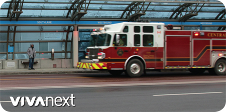
There are a few others who are allowed to drive in the rapidway lanes. Ambulances, fire engines and police cruisers are permitted in an emergency to get past traffic quickly and safely. This is an added benefit that the rapidways bring to each community – saving valuable time when it’s truly needed.

Vehicles such as snow plows and street cleaners maintain the rapidways as needed. Maintenance and security staff from YRT/Viva operations and their contractor, TOK Transit, also access the rapidway stations and their marked vehicles may be seen at the far end of a station platform. This part of the platform is ramped on one side for their use – but this ramp should never be used by regular traffic to cross the rapidway.

Pedestrians and cyclists have access to any vivastation via the traffic signals and crosswalk, but should never jaywalk or cycle across or along rapidway lanes. To do this is risky because it’s unexpected and distracting to both Viva operators and drivers in regular traffic. And although we fully support active and alternative modes of travel, you also can’t travel the rapidway lanes in a scooter or wheelchair, skateboard, motorcycle, hoverboard, segway, golf cart, unicycle… or any other interesting mode of transportation we haven’t thought of yet!

You may wonder why Viva buses use the rapidways, but YRT buses don’t. The reason is that YRT buses either need to turn on and off the road frequently to gather customers, or their purpose is different – e.g., more stops, turning into shopping plazas, etc. Viva and YRT routes are evaluated by YRT/Viva’s Service Planning branch on a regular basis, and service changes are made to routes and schedules as needed.

A street that includes a rapidway is a complete street, with space for doing everything in a safe and efficient way.  Hope you get out and enjoy our streets this spring!


Categories
Uncategorized

working together in our community

working together in our community

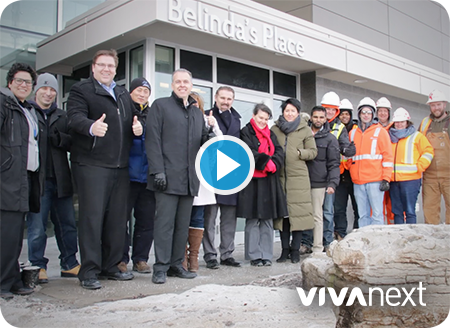
Working together in our community, we spotted an opportunity to help out when the Yonge Street rapidway project team was faced with having to remove 22 landscaping stones to make way for utility relocations. Belinda’s Place, a new multi-service facility in York Region, was making plans to beautify the property after months of construction. So, after making contact and sorting out the details, it was agreed that Belinda’s Place would become the stones’ new home – collaboration and recycling at its best!

Belinda’s Place provides a safe and supportive environment for single, homeless women. It includes 28 emergency beds and nine transitional units for short-term emergency shelter and longer-term transitional housing. Supportive counselling and life-skill learning opportunities are offered to help people find and maintain permanent housing.

As with any large undertaking, there were many players involved to make this happen, but we would like to recognize our partners, Enbridge and Aecon, for doing the ‘heavy lifting’ on behalf of the project.

To see the work they did, watch this video from the event in February.

From the generosity of the original owners of the stones, to the skill and professionalism of the work crews, to the enthusiasm of the staff and residents on hand, a deep sense of pride was evident at each stage of the operation.

A project of this scale is only possible with community-minded partners. The commitment of time, equipment and personnel was put to good use to enrich the lives of so many and ensure true community spirit and recycling of material to a location that will be appreciated by many today and in the future.

For more information on Belinda’s Place, please visit belindasplace.ca


Categories
Rapidways Stations

where will the vivastations be along Bathurst & Centre?

where will the vivastations be along Bathurst & Centre?

We’ve heard your questions about vivastation locations along Centre and Bathurst Streets, so here’s everything you need to know…

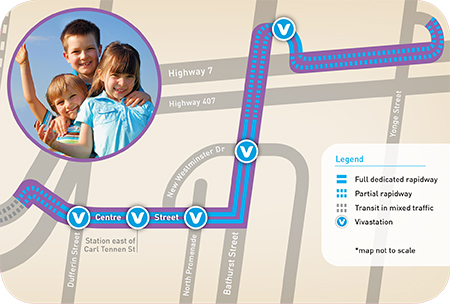
The Phase 2 rapidway project will include 10 new vivastations, with five of them along the current Viva bus route on Bathurst and Centre Streets. This is already one of York Region’s busiest Viva routes, so stops were planned where people will want to get on and off Viva.

From west to east, this is where the stations will be:

  • Centre Street at Dufferin Street.
  • Centre just east of Carl Tennen Street & Vaughan Boulevard.
  • Centre at North Promenade & Disera Drive.
  • Bathurst Street at New Westminster Drive.
  • On the connector road between Bathurst and Yonge Street.

As with all rapid transit in York Region, we plan stations to be walking distance from shopping, important services, and places to live and work. When it’s all done, the Centre and Bathurst area will have updated utilities and traffic signals, tree-lined streets and bike lanes. Preconstruction starts this year, including utility locations and relocations, and watermain upgrades.

For more information about the project, visit our project page. And if you have any other questions, feel free to comment or email us at contactus@vivanext.com. To stay up-to-date on construction, sign up for email updates at vivanext.com/subscribe.