Categories
Construction Rapidways

seeing the transformation unfold on highway 7 west

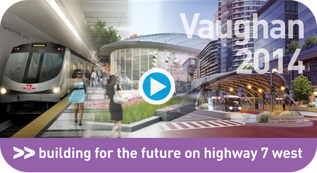
click here to see the video of 2014 Vaughan rapidway construction

we’ve been busy this year

Construction is well underway for the first phase of vivaNext rapidways in the City of Vaughan, and the transformation can be seen along Highway 7 West. Check out our latest video for an up-close look at the milestones we’ve accomplished this year. Although construction will continue throughout the winter months from Edgeley Boulevard to Bowes Road, here’s an update on the progress made in 2014:

  • Traffic has been shifted east of Jane Street to its final configuration, so that work in the centre of the road [including platforms and canopies] can begin in 2015.
  • As part of the 8-metre expansion of the Canadian National Railway [CN] MacMillan Bridge, we poured over 800 tonnes of concrete to create new columns and bridge pier caps.
  • Underground infrastructure revitalization continues – utility, telecommunications and storm sewer relocation is approximately 80% completed.
  • Road widening is completed and base-layer paving is 90% finished between Jane Street and the CN Bridge. Paving activities will continue in 2015.
  • In order to preserve the existing Black Creek and Hillside Culverts, retaining walls were built. In total, five retaining walls have been completed along the corridor with a few more set to get started in 2015.
  • Important traffic and pedestrian changes can be seen at several intersections. Motorists are benefiting from new turning movements and pedestrians now have two-stage crossings.

We know construction can be messy and disruptive at times, and we thank you for your patience and understanding as we continue the transformation. For up-to-date information on construction progress and activities, visit http://www.vivanext.com/hwy7progress.

 

Categories
Construction Rapidways

who, what, where, why, when and how …..the 6ws of davis construction

click here for the video Davis Drive: building more than transit

With Davis Drive rapidway construction well underway, signs of the transformation can be seen along Davis from Yonge Street to Roxborough Road. It takes a lot to build a centre-lane bus rapidway and completely rebuild Davis from the ground up. This challenging project has layers upon layers of complexity and a lot of work underground had to take place first. Check out our latest video about how all these layers add up to a project that’s building more than transit.

A lot of questions can come from a project of this nature, and here at vivaNext we’re always happy to answer them. We thought it might be helpful to break down this complicated project into smaller pieces [like a story with chapters, if you will] to provide a clearer view of how we’re transforming Davis.

Over the coming weeks, we’ll be using Twitter and Facebook to provide a unique behind-the-scenes perspective of the magnitude of work that’s been done under and above ground, the progress we’ve made, what’s to come and of course the end result! We will even toss in a few intriguing facts about Davis Drive and the Town of Newmarket that you may not have known.

What’s a story without pictures? As part of the story, we’ll provide visuals and use pictures to help showcase what’s going on in particular photos. We hope you agree with the adage “a picture is worth a thousand words.”

If you have a question you would like answered as part of our photo series, please contact us through contactus@vivanext.com, send us a tweet or a Facebook message.

We hope you enjoy the story and that at the end of the last chapter, you see that the investment in modernizing our corridor, adding a rapid transit service and revitalizing the infrastructure, will go a long way to making sure Davis is built on a solid foundation that will serve the growing needs of Newmarket for many years to come


Categories
Rapidways

yonge street rapidway – a key connection

video: Yonge St rapidway is on the way

Check out the newest vivaNext video featuring the Yonge Street rapidway project! This rapidway is a key part of York Region’s transit network, and will connect with the Richmond Hill Centre/Langstaff Urban Gateway at Highway 7 – a key Regional Centre with a variety of transit services and transportation options.

Now that the contract has been awarded to RapidLINK, our next step will be to work closely with the contractor to finalize the design of the rapidway on Yonge Street and develop a construction schedule. Over the summer and through the fall and winter months, crews continue working along the Yonge Street corridor to prepare for construction.

During this pre-construction phase, these teams will more accurately document existing conditions above and below the ground. This work is mainly conducted during off-peak driving hours and sometimes requires lane closures.

Building a roadway is a process that follows clearly defined steps and uses modern technology, equipment and materials. Although we have access to some of the best, most experienced construction contractors, building the rapidway down the middle of some of the Region’s busiest roads is a complicated undertaking. That said, we have an experienced team of dedicated staff and constructors who are on board and up for the challenge.

During construction, we realize that it’s important to minimize the impact on businesses and people using the road by keeping travel lanes open whenever possible and safe to do so. For more information on the project and construction information, visit vivanext.com/yonge-street-richmond-hill.


Categories
Construction Rapidways

colour coding the rapidway

colour coding the rapidway

As we’ve posted previously, Bus Rapid Transit [BRT] is an increasingly popular rapid transit technology around the world. One of the ways to make BRT truly rapid, as we’re doing here in York Region, is to provide vehicles with separate lanes so they can move easily through congested areas. And one way to make those lanes distinct without having an actual grade separation is to make them a different colour. This is why the vivaNext rapidways are bright red.

Colouring asphalt anything other than basic black isn’t as easy as you might think. Here’s what we’ve done to get our rapidways red.

Painting asphalt isn’t an option [if only it was this easy]. Although it’s something we all take for granted, creating a long-lasting, durable asphalt mix for the conditions along a busy roadway like Highway 7 is actually a highly specialized science. The surface on roadways that carry a lot of heavy traffic, especially traffic that is constantly turning and braking or accelerating at intersections, needs to be exceptionally strong to prevent cracking, rutting and shifting. Canadian climate conditions, including extreme temperature changes, hot sun, frost, and salting over the winter, all impose significant challenges. Creating an asphalt mix to take these conditions without requiring frequent maintenance is something that specialized pavement designers work hard to achieve, with the technology constantly evolving.

So adding in the requirement to make it a distinct colour definitely adds to the complexity.

Using red pavers or bricks would not provide a sufficiently durable driving surface long term, and would be extremely costly to install and maintain.  One approach that is used when the colour is needed in very limited areas, such as crosswalks or bike lanes, is a material called “street print.” But this material, which is actually a special top layer that’s heated right into the asphalt once it has been imprinted with a brick or paver pattern, would be too complicated to use along the full length of the rapidways [although we are using it for our crosswalks], and again would not be durable enough.

So the best approach is to tint the black asphalt, which we’re accomplishing in a couple of ways. Asphalt is composed of a mixture of sand, stones and asphalt cement binding it together. By adding reddish stones rather than grey ones, we can give an underlying red tint to the asphalt, especially as it wears.

The more complex adjustment is to add a special red pigment. The challenge with the pigment is to be careful in how much we add:  too little and the colour doesn’t come through, but too much and the overall durability of the asphalt could be compromised. The pavement design team has worked long and hard through a highly technical process to get the balance just right.

We’re delighted with their final results, which gives us what we need: a clearly defined rapidway that stands out from the regular traffic lanes, with a long-lasting and durable surface, at an affordable price. Drivers need to remember as they make turns from side streets along Highway 7 to follow the white skip lines and not turn onto those red rapidways!  Although beautiful, they are red for safety too!


Categories
Construction Rapidways

using colour and shape to create welcoming pedestrian spaces

using colour and shape to create welcoming pedestrian spaces

If you’ve walked along the new rapidway on Highway 7, you’ll have seen the vivaNext pavers we’ve installed on the boulevards. We know from the feedback we’ve received that people love the new look.

Most sidewalks in York Region, like pretty much everywhere else, are made of concrete, and the most important consideration is functionality: they need to be safe, accessible, durable and easy to maintain. But beyond those goals, we also want our new boulevards – which are wider than the Region’s regular sidewalks – to reinforce the “complete street” concept – the guiding philosophy for our vivaNext streetscape design. With all the development coming to the Region’s centres and corridors, in the future there will be more pedestrians, whether they live, work, or commute along our rapidway routes. So we’ve made sure that our boulevard design is going to be visually appealing as well as functional.

The boulevard is made up of the pedestrian zone and the furnishing zone. The pedestrian zone is typically a 2m-wide sidewalk which is fully paved with light-toned coloured pavers near intersections, and paved with concrete in the mid-block areas. The sidewalk is a continuous system even across driveways to alert motorists that pedestrians have priority.

The furnishing zone is located next to the pedestrian zone. The furnishing zone is an area where pedestrian amenities and planters are located. It is paved in light coloured unit pavers which reinforce the identity of the vivaNext system.

We’re using a combination of coloured pavers which not only look great but also add to wayfinding for pedestrians. The main field pavers are a light-coloured cool gray with contrasting coloured accent bands, which will increase in frequency as pedestrians approach the main intersections. The east-west accent bands are a red; the north-south accent bands are a dark charcoal gray.

Immediately adjacent to the roadway and running along beside the pedestrian zone is a 610mm-wide “transition zone,” which provides an important comfort buffer from bicycle and vehicular traffic. In the winter months, it also provides an area for snow storage and protects the plantings nearby from salt spray. This zone will be paved in special “eco-pavers,” which allow water to seep through to the storm sewer system.

A charcoal gray coloured textured warning strip will alert visually impaired pedestrians that they are approaching an intersection or driveway. At midblock where the pedestrian zone is paved in concrete, the warning strip will be grooved concrete. Both approaches will provide a tactile clue for visually impaired pedestrians of potential conflicts.

We’ve given special attention to the boulevards near intersections to ensure they reinforce pedestrian priority and add to placemaking. These areas have been designed to function as urban plazas with unit paving and accent pavers. Soft landscaping will define the corners of the intersections and function as gateways to the adjacent areas.


Categories
General Rapidways Stations

ITS – balancing the needs of all travellers

Gridlock is an increasing problem everywhere across the GTHA and most other large cities.  But what can be done about it?  VivaNext is one part of the solution.  With the new vivaNext system comes improved ITS – which isn’t what you think…

Some people may think ITS is connected to “Information Technology”, but in the vivaNext world ITS stands for “Intelligent Transportation Systems”. ITS is an international transportation-engineering discipline that is trying to improve the efficiency of travel, whether it involves the travelling public, commercial vehicles, or transit.  The basic assumptions behind ITS are that delays cost money, and more efficient travel saves money. This new technology is an absolutely critical component of the vivaNext program, although with low-visibility.

ITS is used to ensure that traffic corridors are designed as one coordinated system – the physical roadway’s design, lane markings and signs, traffic signal design and timing, and the brains that connect all these pieces.  In a transit project, ITS has an additional layer which is concerned with how the transit system is integrated into that larger system.

As high-tech as each of these components are, none can be effective unless it can communicate with the others.  Each one also needs to be connected to the overall transit system which keeps track of the schedule for each bus, and which determines when the traffic signal phasing requires a temporary adjustment to let a delayed bus get back on schedule by holding a light.

The connection is provided through a fibre optics communications network that links all of the intersection and every vivastation to YRT’s transit operations and York Region’s traffic operations.

This system is fully automated, with approaching vehicles alerting intersections that they are arriving, and each intersection sharing that information with the central traffic control system, which in turn compares that information with the transit schedule.  The system is continuously adjusted and fine-tuned to ensure the buses stay on schedule, while keeping the roads and intersections working well for everyone.

To enhance passenger safety, each station is equipped with cameras to monitor the platforms, a public address system to provide announcements and an emergency call box for personal safety.  All of these systems operate reliably and seamlessly over the new fibre optic communications system.

The future Highway 7 will be significantly more urbanized, with more people living and working along the corridor.  That means there will be more transit riders, pedestrians and cyclists whose travel requirements need to be considered, in addition to car and truck traffic.  Helping transit vehicles stay on schedule is also a priority, since rapid transit can’t be rapid if it’s stuck in traffic.

These ITS strategies help balance everyone’s needs, to get everyone there as fast as possible!  It truly is a balancing act!


Categories
Construction Rapidways

bringing the vivaNext long-term plan for the future to life

video - Highway 7 East: summer update 2014

With crews working on the finishing touches on the eastern half of the Highway 7 rapidway, we’re getting closer to the completion of this rapid transit corridor. As much as we’re looking forward to celebrating this milestone, it’s only one [very exciting] step in a long path that started years ago.

There’s a lot of media coverage these days, of transit needs all across the Greater Toronto and Hamilton Area [GTHA], and we’re proud that York Region is actively working to bring rapid transit to our region. In 2002, the Region produced the York Region Transportation Master Plan and the follow-up Rapid Transit Plan, committing the Region to a blueprint of multiple transportation initiatives to be built over the next 30 years.

With approval to the Rapid Transit Plan, we got to work and in 2005 the Viva team launched “QuickStart,” the first phase of Viva service. Viva offered enhanced features that made transit more comfortable and convenient, and put the customer first. With ridership levels increasing steadily, Viva changed the way people in York Region thought of transit and there was appreciation for the higher level of services with enhanced features and frequencies.

But while our new Viva service was a major success and an important first step in encouraging people to try transit, designing the vivaNext rapid transit system was the Region’s long-term vision. Ontario municipalities are mandated to plan sustainable, more intensive land-use as part of the provincial government policy, and rapid transit is a key component in achieving that goal. Anticipating this, the Transportation Master Plan directed that future growth in York Region would be concentrated in new downtowns in Markham, Newmarket, Richmond Hill and Vaughan. By building more intensively in these areas, there would be less pressure for growth in existing neighbourhoods.

These urban centres would be connected by transportation “corridors,” making it easier for people to get around the region and providing transportation options, such as regular transit service. The vivaNext rapidways are being built along the corridors, providing these connections across York Region and into the rest of the GTHA.

Much of the new development being built around vivastations is compact and mixed-use, providing housing, employment, retail, dining, services and recreation, all within walking distance of transit. Developments include more welcoming public spaces, attractive landscaping, and other amenities that contribute to the centres becoming more dynamic destinations.

The plan is well and truly underway, and rapidways are being built on Highway 7 in both the east and west, as well as in Newmarket. The Toronto-York Spadina Subway Extension is under construction, and the designs for rapidways on Yonge Street are being finalized. Great new developments are popping up all over the new urban centres across the Region.

So when the next segment of rapidway on Highway 7 East starts service this summer, we can all celebrate the implementation of the first phase of our transportation and growth management blueprint, not to mention the end of construction! Check out the new video highlighting the Highway 7 East segment.

Categories
Construction Rapidways

signs of progress

signs of progress

We’re really counting down the days to the next section of the vivaNext rapidway service opening on Highway 7 East from East Beaver Creek Road to South Town Centre Boulevard, and we know you are too! You’ll know we’re really in the final stretches of construction once you see Viva buses out on the new section of rapidway starting next week.

YRT\Viva will be doing driver training and testing on the Highway 7 East new section in the City of Markham, starting July 28 for a few weeks.

Training will be provided for everyone who will need to be familiar with the rapidways, the stations and equipment. There will be vehicles out on the rapidway, taking customer service staff and other YRT\Viva staff along the rapidways to test and familiarize themselves with the new section. Regular transit service will continue to pick-up passengers at the curbside stops, while we do the testing and finish paving the new section. Signs directing passengers will be posted at the stops.

The actual operator training will run from 7am to as late as 9pm some nights, seven days a week. During this time you can expect to see Viva buses running up and down the rapidway, and stopping at stations. The training will focus on entering and exiting the rapidway, and especially entering back into mixed traffic under Highway 404 and past South Town Centre Boulevard.

Training will also focus on the new transit signals at intersections, which will provide a single green arrow for transit operations. This signal will be clearly marked as being for transit only, but YRT\Viva operators will be trained to be cautious and on the lookout to make sure members of the driving public are obeying the signals correctly and not turning into the red rapidway lanes.

The trainees are all experienced Viva operators, so they know the route and the vehicle and have been enjoying the first phase of the rapidway that opened last year on Highway 7; this is just another segment of the system now running in its own dedicated lanes. They’re really excited to get going, knowing that there are just few more weeks of construction ahead of them.


Categories
Construction General Rapidways Stations

signs, signs, everywhere a sign

It seems anywhere and everywhere you go these days there’s a sign of some type that catches your eye. Whether it’s an advertising, traffic or directional sign, it’s meant to grab your attention. The purpose of all the signs out there is for people to watch and read them every day as they pass by, so that you know what is going on in their neighbourhoods.

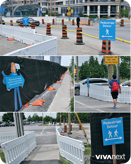
With the large number of signs out there you may become desensitized, but the signs in construction zones are there for your safety. A busy season of road work is underway on several vivaNext projects, so we hope drivers and pedestrians pay close attention to construction markers and signs as they may change daily depending on the work.

For pedestrians, crossing between intersections is tempting. But during construction, it’s especially important to cross at crosswalks – lane closures can change frequently and although construction areas are well marked, drivers may not see a pedestrian crossing unexpectedly.  When large equipment and trucks are working in an area, it is especially confusing if workers are not expecting people in their work zones, so please make sure you are in a safe area, which will be well marked with a sign, of course.

We understand the frustration of being a driver stuck in traffic too, and we’re using large digital signs on the street, to let you know ahead of time about lane closures and detours, as well as providing current travel times.   We hope these signs help you plan your route accordingly and help you manage your travel times.  To receive regular updates about our construction projects, subscribe to our email notices. And for on-the-go traffic alerts about our construction, follow us on Twitter.

Whether you’re biking, walking or driving this summer, we hope you’re enjoying the weather, staying alert and following the signs that keep you safe.

Categories
Rapidways

BRT around the world

BRT around the world

The buzz surrounding Bus Rapid transit [BRT] systems that emerged in the early 2000s has not died down. Cities around the world are continuing to invest in rapid transit projects as an affordable and reliable way of connecting people to job opportunities and leisure activities. As of October 1st, 2013, the transit experts at EMBARQ have reported a total of over 300 bus corridors around the world, spreading to 163 cities across 38 countries.

I’ve discussed BRT systems around the world before, focusing on Curitiba, Brazil and South America’s leading role in rapid transit development. Now, cities in places from Indonesia to South Africa have bus corridors in operation that are positively impacting their growing urban landscapes. Check out some fast-facts on diverse cities who have embraced BRT and view images on our Pinterest board:

Johannesburg, South Africa [Rea Vaya]

  • Hit the road August 30, 2009
  • Rea Vaya means “we are going”
  • 48 stations and 10 median key stations are currently operational on 59 km of trunk routes
  • Commuters stand to save an estimated 73 million hours by shifting to BRT between 2007-2026. The travel time saved is equivalent to over 9 million 8-hour workdays [Embarq].

Brisbane, Australia [Brisbane Busways]

  • Hit the road September 13, 2000
  • A 25 km network of busways, including the South East, Northern and Eastern Busways

Jakarta, India [TransJakarta]

  • Hit the road January 25, 2004
  • First BRT system in Southern and Southeast Asia
  • 12 corridors in operation with over 200 stations along the closed trunk system
  • Carries more than 350,000 passengers daily

Mexico City, Mexico [Metrobús]

  • Hit the road June 19, 2005
  • Transports over 850,000 passengers daily
  • 2,000 days of lost work due to illness were prevented by reducing local air pollution and emission on the Metrobús Line 3 [Embarq]

Istanbul, Turkey [Metrobüs]

  • Hit the road September 17, 2007
  • Approximately 50 km in length and has 45 stations
  • Used by a number of Metrobüs lines
  • Carries around 800,000 people daily
  • In Istanbul, the average passenger on Metrobüs saved 28 workdays per year in reduced travel times [Embarq]