Categories
Subways

because it can’t wait

because it can't wait

If you’ve been following the conversations about transit projects in the media recently, you’ve probably heard some of the debate around which project should be built first. We’ve been following the debates too, and we’ve come to the conclusion that the Greater Toronto and Hamilton Area [GTHA] needs as much transit as possible.

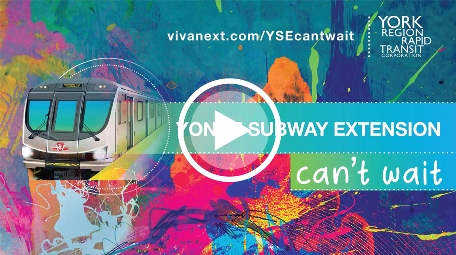
The Yonge Subway Extension [YSE] has been in York Region’s Transportation Master Plan since 1994, and here at YRRTC we’ve been working on moving it forward since we became a corporation in 2003. We of course support the YSE being built, but it’s not just a matter of one project. It’s a connected network. It’s commuters crossing municipal boundaries. And it’s important that it all come together in the next decade or so.

Why? Well partially it’s because there hasn’t been enough transit built in the past 50 years and we need to catch up a bit. And we also need to keep up with the growth to ensure the number of people, businesses, jobs and housing continue to grow in York Region and the GTHA.

  • York Region is expected to grow from 1.2 million residents to 1.5 million by 2031
  • York Region has 51,000 businesses, and together with the Toronto provides 2 million jobs – equal to about 11% of Canada’s labour force
  • York Region has an average of 13,000 new jobs every year, and over the last five years, our workforce has grown at 3.1% on average, surpassing growth rates in the nation, province and GTA
  • In the southern part of York Region, Markham and Vaughan are two of the GTA’s four employment “Megazones” and together with Pearson airport these zones have more jobs than Downtown Toronto
  • Toronto residents make over 189,700 trips per work day to York Region, and even more trips are southbound, supplying employees and customers to help Toronto’s businesses thrive

TTC’s Line 1 is currently over capacity during peak hours. There are capacity improvements required that will help with this, like the Line 1 extension to Vaughan [opened in 2017], TTC’s automatic train controls, new signals, six-car trains, and Go Expansion/SmartTrack. Large infrastructure projects like the Yonge Subway Extension can take 10 years to complete, so the YSE can be built in parallel with the capacity improvements in the next 10 years.

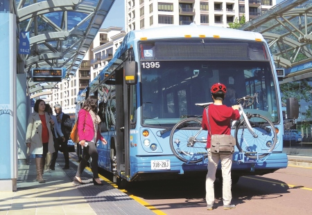
Building the YSE will help reduce traffic congestion – eliminating the almost 2,500 bus trips per workday on Yonge Street between Highway 7 and Finch Station, and giving commuters who drive between Toronto and York Region the chance to get out of traffic.

So which projects should be built first, and which should wait? We need as much transit as possible, so let’s consider all options, and try our very best to get the GTHA moving. Because it can’t wait.

Categories
Transit

transit in York Region >> the facts

transit in York Region >> the facts

If you haven’t taken transit for a while, or are new to York Region, you may need to know a bit more about our system, and how it works.

A recent article in the Markham Economist and Sun pointed out 10 Helpful facts About York Region Transit, and it reminded us that not everyone knows the basics. We’ll cover some of the facts here, and explain a few things along the way.

history

In 2001, transit in four of York Region’s nine municipalities merged to become York Region Transit [YRT]. This was following through on a vision to have a fast, convenient, seamless transit system across York Region. York Region’s bus rapid transit – Viva – was launched in 2005, with curbside vivastations and distinctive blue buses [pictured above] custom-designed with higher capacity and enhanced comfort. More frequent service, prioritizing traffic signals, and off-board payment all meant improved service.

Viva curbside was just the beginning. In 2010, we at YRRTC began building rapidways – dedicated lanes and stations for Viva buses. As of today, we have 12.2 km of rapidways, and 18 vivastations built and open for service. By the end of this year, we should have 15 more kilometres of rapidways and 13 more stations [each station has two platforms and blue canopies – one for each direction] open for service.

Aside from YRT Local [white buses] and Viva [blue buses], YRT also operates Express routes with fewer stops during rush hours, and On-Demand service in locations and time periods with lower demand, and used by customers who need assistance or who have disabilities.

statistics

Two things stand out in YRT’s stats: many customers travelling, across a huge area. On a typical weekday, YRT serves more than 77,000 customers, and in 2016, there were 22.8 million customers. York Region is 1,762 sq. km, almost three times larger than Toronto, and 24% of the Greater Toronto Area.

To serve such a big area, YRT has a fleet of more than 500 vehicles, operates 128 bus routes and serves more than 5,300 bus stops and vivastations.

fares

While it’s possible to pay using cash either on board a YRT bus, or at a ticket machine at a vivastations, it’s convenient and a little cheaper to use a PRESTO card or the YRT Pay app [free for iOS or android].  Without these, fares are $4, or $4.50 to ride Express, or $1 to ride to GO. Using a PRESTO Card or the YRT pay app, fares are currently $3.75 for adults, $3 for youth, $2.35 for children/seniors, $4.25 to ride Express, and still $1 to ride to GO. When you board a Viva bus you can use either the front or back door and have your proof of payment ready in case YRT staff asks to see it. Fares can change over time, and when you cross borders, so if you haven’t been on YRT in a while or you’re planning to travel to & from Toronto, download YRT’s Fare Guide.

more info

Have more questions? Visit YRT.ca for schedules and maps, and excellent trip-planning tools that will tell you how to get where you’re going. They also have a feedback form and live chat options on their website, or if you need to hear a voice, call 1-866-668-3978.

future transit in York Region

Transit grows along with our vibrant city centres and busy streets. Our projects here at YRRTC include more rapidways opening in the next two years, and two YRT bus terminals – in Vaughan and Markham. Future plans that require funding include building over 75 km of rapidways along other corridors – connecting Yonge Street between Newmarket and Richmond Hill, extending Highway 7 to eastern Markham and western Vaughan, and adding Viva along Jane and Leslie Streets, and Major Mackenzie Drive. There’s more to explore of course. You can learn from YRT about their Service Plans, and learn about rapidway projects on vivanext.com. Happy travels.


Categories
General

from our family to yours

from our family to yours

This time of year, it’s all about relationships and family. Valentine’s Day has just passed, and now it’s Family Day weekend. Every family is a network, a group with things in common.

In York Region, there is a family of transit services operated by York Region Transit [YRT]: Local, Express, Viva, and On-Demand. Express and Viva sound alike, but while Express shuttles rush-hour customers to connection points with few stops in-between, Viva provides frequent service along some of our busiest roads, in dedicated bus lanes where possible.

Families are built and maintained with relationships, and yes, we can compare that to transit too. It’s the relationships between York Region Rapid Transit Corporation [YRRTC] and other organizations that move our projects forward.

  • York Region owns YRRTC [our shareholder], and we report to a Board of Directors made up of municipal Mayors and Regional Councillors.
  • Our projects are funded by all levels of government, sometimes private organizations and even other projects. The Province funded 100% of our rapidway projects through Metrolinx. Our maintenance facility in Richmond Hill and the Cornell Bus Terminal are funded by Federal, Provincial, and Regional government. SmartCentres Place Bus Terminal is funded by the Province, York Region, some funds from the Toronto-York Spadina Subway Extension project [TYSSE], and you guessed it – SmartCentres.

Aside from funding, some of the most valuable relationships we have are the ones we build as we construct our projects. We work closely with contractors and utility companies to ensure each project moves forward, with as little disruptions as possible to the community. Our Community Liaison team works directly with local residents and businesses affected by our construction. We know it’s important to keep everyone aware of what’s happening, and who to email or call if you have a question.

Our family is working to grow York Region’s rapid transit network, so if you’re out this Family Day weekend, be sure to explore the places transit can take you – from tobogganing to ice skating or just checking out some of the local businesses. From our family to yours, we wish you the best of this long weekend.

Categories
Announcements Facilities and terminals Stations Subways Transit Urban Planning

a connected transit terminal

a connected transit terminal

This morning, we marked the beginning of construction for a new YRT bus terminal in Vaughan Metropolitan Centre [VMC]. The news release gives the basic project information, but doesn’t delve into how this terminal will connect in the GTA transit network:

bus

Well, it is a bus terminal. YRT buses will use this terminal, taking customers in and out of York Region’s neighbourhoods and to places farther away like Brampton and northern Toronto. Customers will also be able to walk to the VMC vivastation in the middle of Highway 7, where Viva will take them away on dedicated bus rapid transit lanes. They’ll walk about two minutes above ground, or when the weather is frightful they’ll take the underground path and escalator, elevator and stairs to reach the vivastation.

subway

Customers will take the underground path or walk along landscaped paths outside to the VMC Subway Station entrance just south of the terminal, to access the underground concourse for the Toronto-York Spadina Subway Extension. The subway concourse is actually under the vivastation on Highway 7 – stay tuned for a future blog about this.

walking and cycling

The VMC area is planned as a walkable area with tree-lined sidewalks and places to live, work, shop and take transit. The terminal will meet accessibility standards, and customers will be able to walk or cycle there from any direction.

driving

The terminal is near the intersection of Highway 400 ad Highway 407, so a passenger pick-up and drop off [aka. “kiss ‘n ride”] will be included, encouraging carpooling.


So it’s not your typical bus terminal and it’s more than a place to wait for the bus. It’s about connections, and where they’ll take you from here.


Categories
Urban Planning

the last mile is the hardest

the last mile is the hardest

The “last mile” has a reputation. It’s been known as the hardest and the greatest, the final step in getting somewhere, regardless of what that involves [or how far it actually is].

Earlier this month, Ryerson City Building Institute released a video trailer in advance of a Last Mile Meetup event they hosted. The video and meetup invited conversation about the #LastMile, and was the basis for a Toronto Star article. The GTA includes lots of suburban cities and towns. And where there are suburbs, there is that last mile challenge – the beginning and end of a commute to work or school. While most of the commute might be easily done with rapid transit, the last mile usually relies on driving, cycling, walking or taking local transit.

Driving that last mile to a commuter transit station might mean parking in a massive, overcrowded parking lot. Walking or cycling are natural choices as long as there are safe, accessible places to and from the station – this of course depends on weather and the distance travelled. Transit is a good option, but we understand that bus schedules don’t always fit in with the always-in-a-hurry commuter and routes may not get riders close enough to their final destination.

This last leg of the journey can make or break the commute. It’s often the deciding factor on whether the entire commute will be done by car or by transit. Everyone’s trip is unique, and might involve extra stops along the way, like picking up kids from a babysitter or stopping for groceries. So there need to be options, and each option needs to be flexible. To arrive at the right solutions for the last mile, most agree that new ideas need to be piloted, such as the dial-a-ride service in York Region, carpooling, ride-sharing, and safe and secure places for walking and cycling.

It comes down to mobility and quality of life. Mobility is about being able to get to and from where you live easily. Your daily quality of life may depend on how you travel that last leg of the journey – is your last mile the hardest… or the greatest?


Categories
Fun & Games Live-work-play

learning outside the classroom

learning outside the classroom

While your kids may lament the early mornings and long days that come with being back in school, there’s no denying the amount of pride they feel when they learn something new.  This fall, embrace learning by visiting York Region’s centres of culture and education.

Markham: Flato Markham Theatre

Located just off of Highway 7 at Warden Avenue, Flato Markham Theatre is a cultural destination for everyone, regardless of their tastes or interests.  This season, Flato Markham Theatre is housing a wide variety of showcases.  From concerts, to tributes, to dance shows, to local theatrical productions, there’s something for everyone, and with it’s convenient location at Highway 7 and Warden, everyone can get there with Viva.

Vaughan: Ansley Grove Library

Ansley Grove Library is attached to Chancellor Community Centre just north of Highway 7 in Woodbridge, and is home to a variety of books, magazines and multimedia materials in many languages including English, French and Italian.  The library also features a children’s room, where events for little ones are put on throughout the year. When you’re done, take an easy walk to Highway 7, where transit will get you home.

Newmarket: Elman W. Campbell Museum

Located on Historical Main Street in the heart of Newmarket, the Elman W. Campbell Museum serves as an educational connection to Newmarket’s history.  The museum is a non-profit educational centre created to preserve and display local artifacts. The Elman W. Campbell Museum also hosts events, including Culture Days open houses and family Halloween parties. This destination is a “can’t miss” for those looking for a compelling, educational outing, just a short walk from Viva Yellow.

These are just a few – every town or city has places to learn and experience culture and history. YRT and Viva will get you to and from the theatre, the library and museum, and since you don’t have to do the driving, bring some reading material and learn on the road! Wondering what your transit options are? Try downloading the YRT/Viva app!


– Sydney Grant, student Public Relations Coordinator


Categories
Technical Urban Planning

green light, go light

green light, go light

When it comes to traffic lights, there is a clear favourite: no one likes red, but everyone loves green. And those advanced green arrows are great, except that they never seem to last long enough. Seriously, traffic signals are one of those aspects of commuting that we all have strong feelings about. But what determines when a light changes from red to green, and how long that advanced green should last? Let’s try to shed some light on that…

There’s nothing random about the timing of traffic signal phases, and their design has only one goal: to move traffic and pedestrians as freely and safely as possible along our roadways. As with all aspects of civil and urban design, things are more complicated than they might seem, requiring clear priorities and tradeoffs to balance out everyone’s needs. Here are the basics.

In traffic engineering-speak, a signal phase refers to the operation for all approaches to an intersection [e.g., a red light will show for a side street at the same time as the main road has a green light]. A cycle is the entire combination of phases for an intersection [red, green, amber, advanced green etc.]. A cycle can range from 90 to 160 seconds [meaning if you miss a green light, that’s how long you could wait until the next one], although the timing depends on the intersection and the time of day.

Determining what phases are needed for the cycle, and how long each phase will last, reflects the needs of all users – including transit, pedestrians, cyclists and drivers. Some phases in the cycle length ensure that road users are not in conflict with one another [for example, drivers can’t exit a side street at the same time as drivers are going straight through on the main road]. Also, some users’ needs will be parallel within a phase – e.g., pedestrians, transit and drivers all travelling in the same direction.

Decisions about phases, and how long they last, take into account actual traffic volumes and how traffic patterns change throughout the day. Timing is designed to make the intersection work as efficiently as possible [meaning moving through the largest numbers of users], and minimize delays for all road users [although with many roads at or over capacity during rush hour, signal timing alone can’t solve congestion]. Signal priority is also provided to fire, ambulance and transit, where the signals change to provide priority right-of-way to emergency vehicles and some transit vehicles, without violating the pedestrian timings.

Timing for each phase is based on the minimum timings required by provincial standards. These include minimum timings for pedestrians, motorist and vehicle clearance [amber and red timings] based on several factors, including the width of the intersection, and traffic speed [posted and operating].

Proximity to other infrastructure also has an impact on priorities and the timing of phases. For example, the Ontario Ministry of Transportation may have jurisdictional control over the timing of lights at some intersections, depending on how close the intersection is to a provincial highway off-ramp or railway crossing.

Ultimately, any one cycle has only so many seconds, and no one wants to wait longer than they have to. So the design of traffic signals needs to balance everyone’s needs, while working out the best way to move traffic through an intersection and along a thoroughfare, and minimizing delay for all road users. York Region’s Traffic Signal Operations department continually reviews and assesses the performance of the region’s 848 signalized intersections, and adjusts signal timing to get people moving as freely as possible. Please contact traffic@york.ca if you have any traffic signal concerns.

Whether you’re crossing intersections on foot, bus, bike or car, traffic signals are there to move everyone along safely.


Categories
Subways Urban Planning

subway in the GTA: where & when to build

subway in the GTA: where & when to build

With the launch of the #YongeSubwayNow petition and campaign for full funding of the Yonge Subway Extension, there has been a lot of conversation around where subway should be built, and whether the Yonge Subway Extension or Downtown Relief Line should be built first.

At York Region Rapid Transit Corporation [vivaNext] we’ve been leading the design and engineering studies for the Yonge Subway Extension, so we have a few thoughts on these important topics.


considering the options

To some it might seem as if the Yonge Subway Extension is a new plan, but really it’s been in the works for many years, and it’s pretty far along. It was first included in York Region’s Official Plan over 20 years ago in 1994. The Environmental Assessment was completed and approved way back in 2009, and in 2012 the Conceptual Design Study was completed and approved by TTC and York Region.

This isn’t a blind push for a subway – we’ve looked carefully at the options. LRT and dedicated BRT lanes were considered, but due to factors such as narrow road space and high ridership, only a subway will work here.


building in parallel

Transit should not be a York vs. Toronto issue. Instead, the focus should be on what investments will contribute best to helping people get where they need to go conveniently and most cost-effectively. That’s why, for example, we think both the Yonge Subway Extension and the Downtown Relief Line need to be built. And we know the Province of Ontario agrees, because both projects are on Metrolinx’ list of top priority projects. In fact, a relief line that reaches all the way to Sheppard Subway would be particularly helpful to the Yonge Line, especially if a rapid transit connection can be added later to travel north from Sheppard.

Transit expansion benefits people on both sides of our municipal borders. Today, we see a significant number of travelers headed northbound in the AM period to a growing number of jobs in York Region. Cross-boundary transit reduces traffic congestion on GTA roads, and increases the pool of customers and skilled employees for Toronto businesses.

With the current state of transit in the GTA, transit projects that are as important as these shouldn’t be built consecutively. Projects like these typically take at least 10 years to design and build, so they should be built in parallel. We can’t wait for one to be complete before starting another.

A GTA transit network means expanding options and crossing borders. It means we have to move forward with as much transit as possible, in the places where it’s needed. And we can all benefit from that.


Categories
General Urban Planning

automated vehicles >> will transit drive itself?

automated vehicles >> will transit drive itself?

Lately there’s been a lot of news on the topic of automated vehicles. In February, the National Highway Traffic Safety Administration in the US officially stated that an artificial intelligence system [computer] in an automated vehicle can officially be considered a driver. And in at least five global cities, there are driverless buses already on the streets. In aviation, pilots have been relying on auto-pilot for decades when landing and taking off in low visibility, and many people-mover rail systems [such as airport monorails] are automated.

Studies show that, statistically speaking, computers are safer than humans at driving. However, we know that getting from here to there is about more than arriving safely. Comfort is important of course, along with convenience and efficiency or speed. For some, a travel choice is a personal statement – to cycle or walk, to make use of transit, or to drive a certain style of car. Many vehicles already have “driver assistance systems,” with features that brake when an obstacle is detected, and alert the driver when the car in front has moved forward or when the vehicle has left its traffic lane.

So the technology is there, and it’s already being used. The question isn’t whether it will happen, it’s how it will affect how we travel. It will depend on how they’re used – if every individual uses their own automated vehicle, traffic congestion and parking issues will likely remain the same. But if we share vehicles and take transit…our cities and roads could become safer and more efficient.  Interesting topics for discussion and consideration and we continue to follow them with interest.

At vivaNext we’re for mobility – whether this means subway, bus rapid transit, or automated transit in the future, we’re thinking about how York Region’s roads can be prepared and always looking for new and innovative ideas to make improvements.


Categories
Going Green

a touch of nature…

a touch of nature…

…makes the whole world kin. At least that’s what Shakespeare wrote. Everyone wants to help out the environment, even just a little. And the key to making that happen is to weave it into what you do. At vivaNext, we do what we can to help out by incorporating environmental and sustainable standards into what we do.

saving…

When we built a transit facility in Richmond Hill, more than 95% of construction waste was diverted from landfills by recycling. This equals about 582 tonnes, or enough to fill 32 city buses. The facility was built to LEED Silver standards, and includes a rainwater recycling system for the bus wash, which saves about 5.5 million litres each year. When we build rapidways, the old asphalt is taken to local recycling centres, saving valuable construction material for re-use.

planting…

Every rapidway project includes tree-lined sidewalks with special under-sidewalk root systems and tree and shrub species chosen to best suit their location. Including greenery in our communities has important side benefits, including improved health for residents, increased property values, better business outcomes, and reduced energy costs. Each project is unique, and where there are creeks and culverts, our work includes natural restoration, which creates better conditions for wildlife and aquatic species. For a peek at how we connect with nature, check out our video.

building!

And don’t forget the most important thing we’re doing – building rapid transit! Adding sustainable travel choices to our landscape is the most important thing we can do to help our communities thrive. Each bus can replace up to 70 cars and during peak hours along rapidway routes, can be up to 42% faster and certainly reduces emissions. Having fast, reliable transit within walking distance helps support the growth coming to our downtowns in Markham, Newmarket, Vaughan and Richmond Hill – and this central growth helps prevent suburban sprawl.

We’re doing what we can to help the environment and making it part of what we do. Earth Hour is 8:30-9:30pm this Saturday, and we’ll do that little bit extra by powering down and we hope you will too.